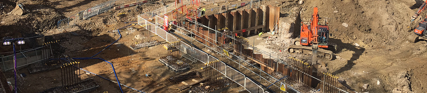
Any construction site is likely to be affected by the presence of existing utilities. Having the utility asset maps available is essential. However, having a utility survey completed before any work commences is required to comply with relevant legislation.
OVERVIEW
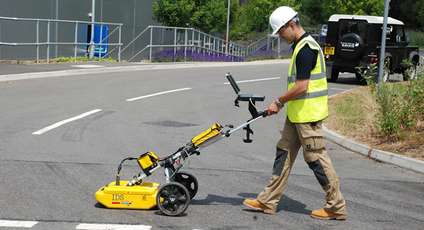
Premier Energy’s survey team use the latest equipment and techniques, such as Electro Magnetic Locators (EML) and Ground Penetrating Radar (GPR) to trace and map the locations of buried utility assets produce a Utility Information Drawing in DWG AutoCAD and PDF format. This enables you to minimise the risk of damage to existing utilities and avoiding possible injury to construction personnel.
WHY CHOOSE US?
Our survey team are PAS 128 compliant, qualified to ProQual Level 5 in Utility Mapping and Surveying and are classified as Senior Utility Mapping Surveyors by the Construction Skills Training Academy.
As well as tracing buried utility assets, the survey team can also identify service intakes, meter locations and meter numbers (to assist in disconnection later on in the project lifecycle).
We specialise in utility surveys only and therefore understand what we need as part of our Consultancy service and provide a high level of detail.
Our deliverable also assists our clients with CDM Regulations and HSG47 compliance.
THE SURVEY
- Our Utility Search Premier service will obtain asset maps from the utilities
- Client to provide asset maps of private infrastructure within the site (if available)
- Client to provide topographical survey in DWG format
- Our experienced utility surveyors will identify assets on-site
- Electro Magnetic Location (EML) equipment will trace conducting lines e.g. metallic gas or water pipes and cables
- Ground Penetrating Radar (GPR) will be used to trace non-conducting services e.g. plastic pipes, PVC ducting, asbestos cement pipes etc., where ground conditions and size of service allow.
- Flexitrace/sondes used to trace smaller diameter ducts for telecoms cables
- A comprehensive plan of buried services within the survey boundary area is provided
- Drawings are issued in AutoCAD and PDF formats
PAS 128
As part of a suite of services we offer we can cover the requirements of PAS 128. Our Utility Search report provides Quality Level D whilst our Surveys team can offer Quality Level C, B and A.
CDM REGULATIONS
From 1st April 2015 there are new Construction, Design and Management Regulations. These new rules require the Client and Principal Designer to deliver to the Contractor pre-contract information. Buried services, being a major health and safety risk, are no longer just the Contractor’s responsibility to do proper utility discovery.
HEALTH AND SAFETY GUIDE NO. 47 (HSG47)
“Avoiding Danger from Underground Utilities”, updated in 2014, now goes as far as to suggest that clients buy a utility report or use a searching system. This is because of the complexities of who owns which assets since deregulation. It goes on to give guidance on recording where contractors move plant.
The guidance also has recommendations for the use of locating devices in detecting buried services.
More can be expected when PAS 256 “Buried assets – Collection, recording and sharing of location information data” is finalised through the BSI.
POTENTIAL FOR PROSECUTION
All three of these regulations are tools that are likely to form key parts of any Health & Safety Executive prosecution in the event of any non-compliance that leads to an accident.
WHO ARE OUR CLIENTS?
- Developers, Local Government and Housing Associations
- Highways, Transport, MEP Consultants and Engineers
- Individuals looking to carry out works around utilities
- Anyone involved in the management, planning, design, modifying, construction and safety of projects who requires utility plans in an AutoCAD DWG format